|
 |
|
"PX"
|
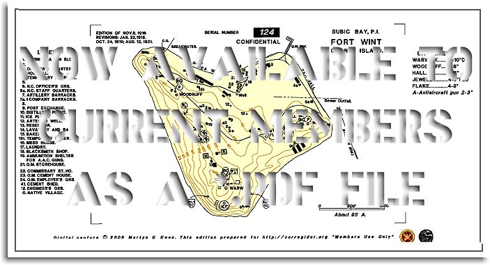
�THE 1921 FORT WINT (GRANDE ISLAND) MAP -
This map of all civil and military constructions and military facilities on Grande Island as of Aug 12, 1921. It is professionally redrawn as a single sheet, in its entirety from the original sheet formerly classified as CONFIDENTIAL. Reproduced in exquisite details by our Mapmaster, Martyn Keen. This map is a window through time into the heyday of the pre-war Philippines. It displays all buildings and features on a single map with a redrawn and corrected building legend; This single sheet map is supplied for a $5 donation received from CURRENT MEMBERS members. Delivery via e-mail will be as a *pdf file with your surname as password. You will be able to print your map on any size paper and the full size map will print to the maximum scale of 1:6,000 on a drafting plotter at 1189 X 900 (AO sheet). |
|
Being a *.pdf file, this map can be enlarged and printed with perfect clarity.
|
|
ALL MAPS ARE LICENSED TO MEMBERS FOR THEIR EXCLUSIVE, NON-TRANSFERRABLE PERSONAL USE ONLY. |
|
|
combat over corregidor | amid th' encircling gloom | 503 the rock regiment | moments in passing | MORE MOMENTS | retaking corregidor 1945 | |
|
|
|
|